Have you ever wondered how we understand the world we live in? How do we use geography to navigate our surroundings, explore new places, and make sense of the Earth’s diverse landscapes? Welcome to our blog post on the fascinating topic of fieldwork in geography!
Geography, in simple words, is the study of the Earth and its features, both natural and human-made. It helps us understand how people, places, and environments are interconnected. But how does geography come to life? Enter fieldwork – the hands-on, boots-on-the-ground approach that geographers use to collect data, study landscapes, and gain a deeper understanding of our planet.
In this blog post, we will delve into the world of fieldwork, exploring its purpose, methods, and the tools geographers employ. We’ll also look at different types of geography, map essentials, and the role of fieldwork in understanding physical geography. So, grab your compass and join us on this exciting adventure through fieldwork in geography!
What is Fieldwork in Geography?
Fieldwork in geography is the adventurous soul of the discipline, flamboyantly donning its hiking boots and sallying forth into the world. It is the bold voyage of exploration that allows geographers to break free from the confines of their dusty offices and embrace the vibrant beauty and complexity of the natural world. So, grab your backpack and prepare for a wild ride as we delve into the thrilling realm of fieldwork in geography!
Fieldwork: Unleashing the Inner Indiana Jones
Fieldwork in geography is like being a modern-day Indiana Jones, minus the fedora and whip (although those accessories are highly recommended for establishing an appropriately adventurous aesthetic). It involves venturing out into the field, quite literally, to gather firsthand data and observations. It’s all about getting up close and personal with the landscapes, ecosystems, and cultures that make our world so fascinating.
A Journey of Discovery
Fieldwork is more than just a fancy jaunt in nature’s playground; it’s a voyage of discovery. As geographers traipse through mountains, traverse rivers, and brave dense jungles, they collect data on everything from topography and climate to flora and fauna. They unravel the secrets of the earth’s processes and uncover valuable insights into the relationships between humans and the environment. It’s an exhilarating quest that combines scientific inquiry with the thrill of exploration.
Methods and Techniques: More Than Just Binoculars and Notebooks
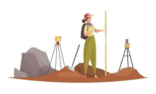
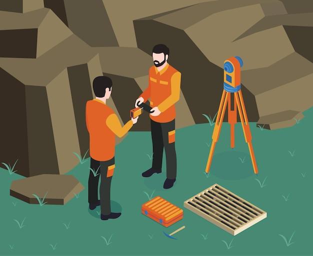
Fieldwork demands a diverse toolkit, no, not just the kind you find in your garage, but rather a metaphorical one filled with a variety of methods and techniques. Geographers employ a range of instruments, such as GPS devices and remote sensing tools, to gather accurate data. They also conduct interviews, surveys, and observations to gain a deeper understanding of the social and cultural aspects intertwined with geographic phenomena. It’s like having a detective’s toolkit fused with MacGyver’s resourcefulness.
Challenges: Not All Smooth Sailing
Fieldwork may sound like a whimsical adventure, but it certainly isn’t without its challenges. Mother Nature can be capricious, throwing unpredictable weather, treacherous terrain, and ornery wildlife in the path of intrepid geographers. Yet it is precisely these challenges that add spice and excitement to the fieldwork experience. After all, who doesn’t enjoy getting caught in a sudden downpour or having a staring contest with a curious mountain goat?
The Importance of Fieldwork
Fieldwork plays a vital role in geography, providing a bridge between theory and reality. It allows geographers to test and refine their hypotheses, validate their research findings, and gain a deeper appreciation and understanding of the world we inhabit. Without fieldwork, geography would be like a symphony without music—a mere collection of abstract ideas and concepts divorced from the pulsating heartbeat of the Earth.
The Call of the Wild
So, the next time you find yourself captivated by a breathtaking landscape or curious about the intricate connections between humans and their environment, remember the intrepid geographers embarking on fieldwork adventures. They are the ones on the front lines, experiencing the thrill of discovery and championing the cause of understanding our world. So, answer the call of the wild, embrace your inner Indiana Jones, and let fieldwork in geography transport you to the realms of excitement, knowledge, and awe. Happy exploring, fellow geographers!
That’s it for this edition of our fieldwork escapades. Stay tuned for more captivating tales from the world of geography!
FAQ: Fieldwork in Geography
How do we use geography
Geography is used in various ways to understand and analyze the Earth and its features. It helps us make sense of the world around us, from studying the distribution of populations and resources to analyzing the impact of climate change on different regions. By using geography, we can create maps, charts, and models that assist in making informed decisions, such as urban planning or disaster management.
What is geography in simple words
In simple words, geography is the study of the Earth’s physical features, climate, and human activity. It explores how natural and human-made factors shape our planet. By examining the relationships between people, places, and environments, geography helps to explain why things are located where they are and how they interact with each other.
What are the geographic tools
Geographic tools are instruments and technologies used by geographers to collect data, analyze information, and create maps or models. Some commonly used geographic tools include GPS (Global Positioning System) devices for precise location positioning, GIS (Geographical Information System) software for data management and analysis, and remote sensing technologies like satellites and aerial photography to gather imagery of the Earth’s surface.
Who uses a physical map
A physical map is used by a variety of individuals and organizations. Geographers, geologists, and environmental scientists often utilize physical maps to study landforms, such as mountains, rivers, and deserts. Travelers and tourists also use physical maps to navigate and understand the natural features of a location before visiting it.
What is primary fieldwork in geography
Primary fieldwork in geography refers to the firsthand collection and observation of data from a specific location or area. It involves going out into the field to conduct surveys, measurements, interviews, or observations. Primary fieldwork allows geographers to gather original data, which is valuable for analyzing and understanding real-world phenomena.
What are the six essentials of a map
The six essentials of a map are:
- Title: A concise and descriptive name given to the map.
- Orientation: The direction in which the map is oriented, usually indicated by a compass rose.
- Legend: Sometimes referred to as a key, it explains the symbols and colors used on the map.
- Scale: Indicates the ratio or relationship between the distance on the map and the corresponding distance on the ground.
- Grid: A system of lines, such as latitude and longitude, used to locate specific points on the map.
- Source: Provides information on the origin or authorship of the map and its data sources.
What is fieldwork in geography
Fieldwork in geography refers to the collection of data and information directly from the field. It involves going to a particular location and conducting on-site observations, measurements, surveys, or interviews. Fieldwork provides geographers with firsthand knowledge and data that cannot be obtained through secondary sources alone.
What are the two main types of geography
The two main types of geography are physical geography and human geography. Physical geography focuses on the natural features of the Earth, such as landforms, climate, and ecosystems. Human geography, on the other hand, explores human activities, behaviors, and their relationship with the environment, including topics like population, culture, and urban development.
What are the three types of geography
The three types of geography are physical geography, human geography, and geographic techniques. Physical geography studies natural features and processes, while human geography focuses on human activity and its relationship with the environment. Geographic techniques encompass the tools, methods, and technologies used in geographical research and data analysis.
What are the five parts of a map
A map typically consists of five main parts:
- Title: Gives a brief description of what the map represents.
- Legend: Explains the symbols, colors, and patterns used on the map.
- Scale: Shows the ratio between distances on the map and the actual distances on the Earth’s surface.
- Compass Rose: Indicates the orientation of the map, usually with the four cardinal directions (north, south, east, west).
- Insets: Additional smaller maps or diagrams included to provide more detailed information or focus on specific areas of interest.
What are some examples of physical geography
Examples of physical geography include studying landforms (such as mountains, valleys, and plateaus), climates (like tropical, arid, or temperate regions), ecosystems (such as rainforests, coral reefs, and deserts), and natural hazards (like earthquakes, volcanic eruptions, and hurricanes). Physical geography explores the Earth’s natural processes and how they shape the planet’s physical features.
What are the seven types of maps
The seven types of maps commonly used in geography are:
- Political maps: Show the boundaries, countries, and major cities of a region or the entire world.
- Physical maps: Display the natural features of the Earth’s surface, like mountains, rivers, and forests.
- Topographic maps: Depict the elevation and configuration of the land using contour lines.
- Climate maps: Illustrate the average weather conditions and climatic regions of an area.
- Population density maps: Represent the distribution and concentration of population in different regions or countries.
- Road maps: Provide detailed information about highways, roads, and transportation networks.
- Thematic maps: Focus on specific themes or topics, such as vegetation, geology, or economic indicators.
What topics are covered in geography
Geography covers a wide range of topics, including but not limited to:
- Landforms and physical features of the Earth
- Climate patterns and weather phenomena
- Population distribution and migration
- Urbanization and city development
- Cultural differences and ethnic communities
- Economic activities and global trade
- Environmental conservation and natural resource management
- Political boundaries and international relations
- Transportation networks and infrastructure
What is a key on a map
A key on a map, also known as a legend, is a section that explains the symbols, colors, and patterns used in the map. It helps readers understand the representation of different features or phenomena on the map. For example, a key may indicate that a blue line represents a river, or a green area denotes a forested region.
What are the three components of a map
The three components of a map are:
- Points: Represented by dots or symbols, points on a map indicate specific locations like cities, landmarks, or individual features.
- Lines: Used to illustrate linear features such as roads, rivers, or boundaries.
- Areas: Represented by colors or patterns, areas on a map depict regions like countries, forests, or parks.
What are the six elements of geography
The six elements of geography are:
- Space: Examines the distribution and arrangement of features on the Earth’s surface.
- Place: Describes the unique physical and human characteristics that define a location.
- Environment: Studies the interactions between human activity and the natural surroundings.
- Interconnection: Explores the relationships and linkages between different places and regions.
- Movement: Focuses on the mobility of people, goods, ideas, and information across space.
- Region: Analyzes the similarities and differences between areas based on certain criteria, such as cultural, economic, or physical characteristics.
Who is considered the first geographer
Eratosthenes, a Greek scholar living around 276-194 BC, is often considered the first geographer. He made significant contributions to the understanding of geography, including developing a system of longitude and latitude, calculating the Earth’s circumference, and creating one of the first maps of the known world.
What is physical geography
Physical geography is the branch of geography that examines the Earth’s natural features and processes. It focuses on studying landforms, climates, ecosystems, and natural phenomena such as erosion, plate tectonics, and weather patterns. Physical geography helps us understand how geographical factors shape the Earth’s physical environment.
Where is the father of geography
The “father of geography” is generally attributed to the ancient Greek scholar, Eratosthenes. Born in Cyrene, located in present-day Libya, Eratosthenes made significant contributions to geography and cartography during the Hellenistic period.
What are the 7 key concepts of geography
The seven key concepts of geography are:
- Location: Describes where a place is situated on the Earth’s surface.
- Place: Refers to the unique physical and human characteristics that distinguish one location from another.
- Human-Environment Interaction: Explores the reciprocal relationship between humans and their environment; how people modify and adapt to their surroundings.
- Movement: Involves the mobility of people, goods, information, and ideas across space and time.
- Region: Groups areas with shared characteristics or features that set them apart from others.
- Spatial Patterns and Processes: Analyzes the organization, arrangement, and distribution of features on the Earth’s surface.
- Scale: Examines the different scales at which geographic phenomena can be studied, ranging from local to global levels.
Now that you have a clearer understanding of fieldwork in geography and its related concepts, you’re ready to embark on your own geographical explorations. Happy mapping!