Welcome to our blog post on the fascinating world of bathymetric profiles! Have you ever wondered what lies beneath the vast expanse of the ocean? Well, bathymetry is the key to unravelling the mysteries hidden beneath the waves.
In this article, we will explore the importance of bathymetry and why it is being conducted. We will dive deeper into the concept of bathymetric curves and the valuable information they provide. From the methods used to map the ocean floor to the challenges faced in this endeavor, we’ll uncover everything you need to know about bathymetric profiles.
So, grab a cup of coffee and get ready to explore the awe-inspiring depths of the ocean as we delve into the captivating world of bathymetry!
What is a Bathymetric Profile
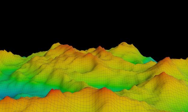
A bathymetric profile is like a black belt in the world of oceanography. It’s a fancy term for a graph that shows the underwater topography and depth variations of a particular area. Essentially, it’s a way for scientists to map out what lies beneath the water’s surface. Imagine it as an underwater mountain range, but without any ski resorts or selfie opportunities.
The Depths of Knowledge
Bathymetric profiles provide a sneak peek into the mysterious and unexplored depths of the ocean. By using a combination of sonar technology and mathematical wizardry, scientists are able to measure and visualize how deep the waters go in a specific location. It’s like putting on scuba gear and diving into the mind of Mother Nature herself.
Making Waves in Science
You might be wondering why bathymetric profiles are so important. Well, these profiles help us understand the hidden world beneath the waves. They show us where underwater mountains, trenches, and valleys lurk, shedding light on the intricate geological features of the ocean floor.
Beyond the Blue
But bathymetric profiles are not just about knowing the lay of the underwater land; they have practical applications too. They aid in marine navigation, helping sailors and explorers safely chart their course through the watery maze. They also assist in planning the laying of submarine cables and pipelines, ensuring efficient and accurate installation.
The Method to the Madness
So, how do scientists create these magical underwater maps? Well, it starts with sound, my friend. By emitting sound waves and measuring the time it takes for them to bounce back from the ocean floor, scientists can calculate the depth at various points. It’s like playing a round of Marco Polo with the sea and getting some serious scientific results.
Unlocking the Secrets
Once the data is collected, scientists use their brainpower and fancy algorithms to transform those numbers into visually stunning bathymetric profiles. These profiles showcase the underwater landscape with contour lines, revealing the highs and lows of the oceanic terrain. It’s like peeling back the ocean’s disguise and seeing its true face.
A Glimpse into the Abyss
In conclusion, bathymetric profiles are the window to the strange, mesmerizing realm that lies beneath the waves. They unveil the mysteries of the deep and provide crucial information for navigation and infrastructure development. So, the next time you’re gazing at the vast expanse of the sea, remember that beneath the surface lies a hidden world waiting to be explored, all thanks to the fascinating science of bathymetric profiling.

FAQ: What is a Bathymetric Profile
Welcome to our comprehensive FAQ-style guide on bathymetric profiles! Here, we’ll delve into the intriguing world of bathymetry, uncovering its importance, the information it provides, and why mapping the ocean floor can be a real challenge. So, grab a cup of coffee and let’s dive in!
Why is Bathymetry Being Done
Bathymetry is essential for understanding our underwater world. It helps us chart the depths of oceans, seas, and lakes, providing crucial information about underwater terrain, currents, and marine ecosystems. By conducting bathymetric surveys, scientists, geologists, and oceanographers gain valuable insights into the geological evolution of Earth, identify potential hazards, and support various industries like fishing, shipping, and offshore drilling.
What is a Bathymetric Curve
Ah, the bathymetric curve! It’s like the ocean’s personal barcode. A bathymetric curve is a visual representation of the water depth along a specific line or transect. Just imagine taking a cross-section of the ocean and plotting the depths against distance. This curve allows us to visualize underwater topography and identify features like canyons, ridges, and seamounts lurking beneath the waves.
What Information is Included in Bathymetric Data
Bathymetric data is like a treasure trove of underwater knowledge. It contains vital details such as water depth, seafloor morphology, sediment composition, and even potential locations of subsea volcanoes and hydrothermal vents. This information helps us identify marine habitats, understand the impact of climate change, and aids in the planning of underwater infrastructure projects. It’s no wonder bathymetric data is highly sought after!
What is a Bathymetric Profile
Picture this: You’re hiking up a mountain and come across a topographic profile, a visual representation of the elevation along a specific line. Well, a bathymetric profile is its aquatic counterpart. A bathymetric profile showcases the underwater terrain along a defined path, displaying depths and variations in seafloor features. Think of it as a vertically flipped mountain, displaying slopes, valleys, and underwater skyscrapers instead of peaks!
What are the Methods of Bathymetry
Oh, the methods of bathymetry! There are various ways to unveil the mysteries of the deep. From traditional techniques like single-beam echo sounding, which measures depth using sound waves, to advanced multibeam systems that provide wider coverage and higher resolution, bathymetric surveys have come a long way. Other methods such as satellite-derived measurements and LIDAR (Light Detection and Ranging) technology revolutionize our ability to map the vastness of the ocean floor. It’s a fascinating world of scientific wizardry!
What Really Lives at the Bottom of the Ocean
Ah, the deep-sea dwellers! You’d be surprised by the extraordinary creatures that call the ocean floor home. From bioluminescent anglerfish to elusive giant squid, the depths are teeming with unique and often bizarre marine life. Along with fascinating organisms, there are mysterious ecosystems thriving near hydrothermal vents, where creatures can withstand extreme temperatures and thrive in a world without sunlight. Exploring the wonders of deep-sea biology is like discovering an alien planet right here on Earth!
Why is it So Hard to Map the Ocean Floor
Mapping the ocean floor is no easy feat, my friend! With over 70% of our planet covered in water, it’s no wonder that the mysteries of the deep still exist. Factors such as treacherous weather conditions, remote locations, and the immense scale of the oceans pose significant challenges. Moreover, the complexity of seafloor features, like rugged canyons and hidden trenches, makes mapping a true adventure. But fear not, intrepid explorers, as advancements in technology continue to enhance our abilities, allowing us to unravel the secrets of the deep blue.
So there you have it! Our comprehensive FAQ-style guide has given you a delightful glimpse into the world of bathymetric profiles. From uncovering underwater landscapes to unraveling the wonders of deep-sea life, bathymetry serves as a vital tool for exploring, understanding, and protecting our oceanic realm. Now you’re equipped with knowledge to dive deeper into the subject, so keep exploring, keep learning, and let the mysteries of the ocean continue to inspire you!